ScanMyArea
Welcome to ScanMyArea, a tool that uses geolocation to identify potential hazards and danger within close proximity, providing valuable assistance in keeping you and your colleagues safe whilst you are on site.
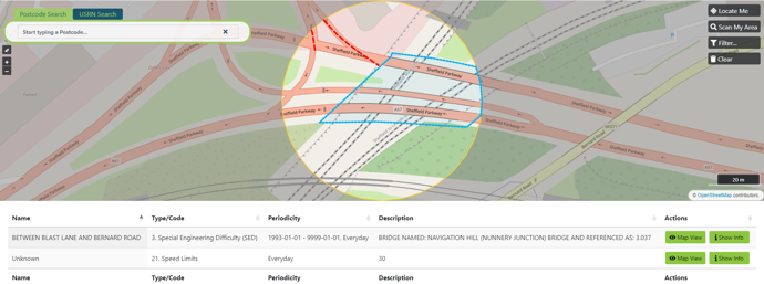
ScanMyArea will access multiple feeds of geospatial data and upon scanning your area it will provide a visual representation with key attribution related to health and safety.
To use this service, you will need to
If you don't yet have an account then please
This service will also require access to your location. Please ensure that GPS geolocation is activated on your device.
Disclaimer
Important to note: This functionality is based on available data in the NSG about hazards/ potential dangers in certain areas and is subject to limitations and gaps in information. It may not always capture every hazard or reflect real time conditions.
It is crucial to exercise caution when assessing hazards and potential dangers in any given location.
